Sunlight partnered with IDEO to develop the third software application in the National Data Apps series. The goal was to make a practical, appealing mobile app that relied on government data and would compel smartphone users to learn more about their immediate surroundings. The design challenge was to create software that would take advantage of existing public data, tap into location-based curiosity and technologies, and require minimal backend maintenance.
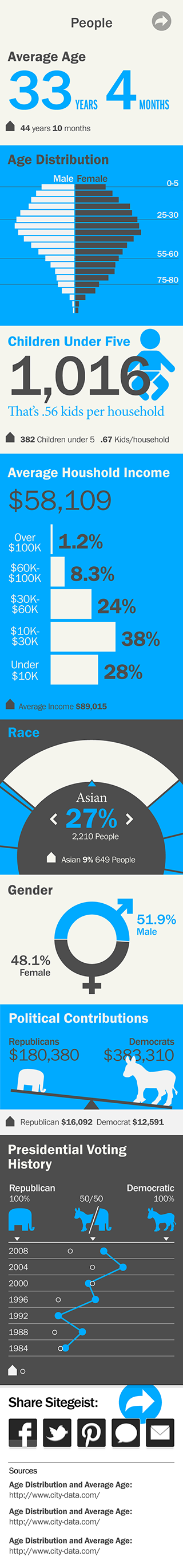
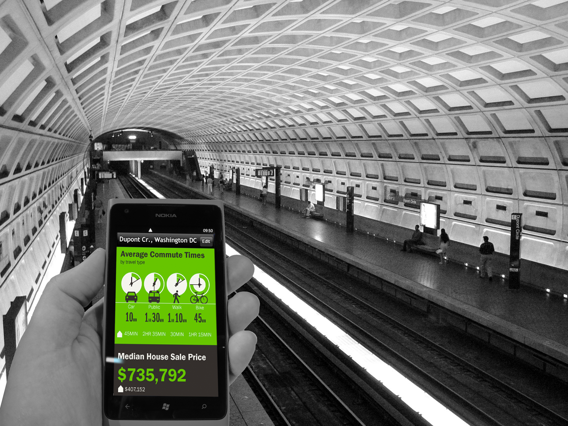
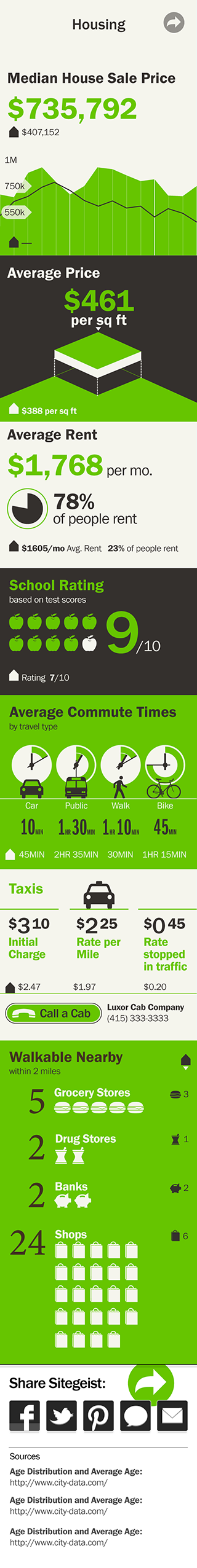
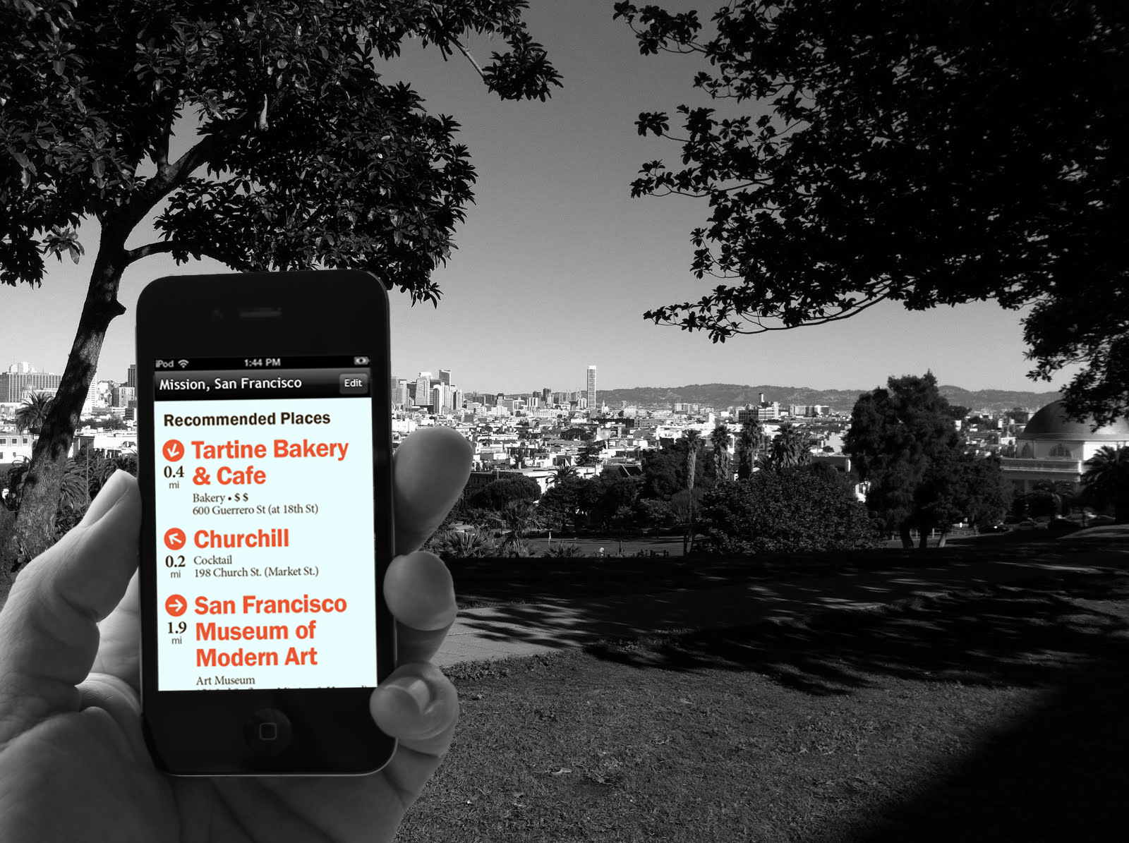
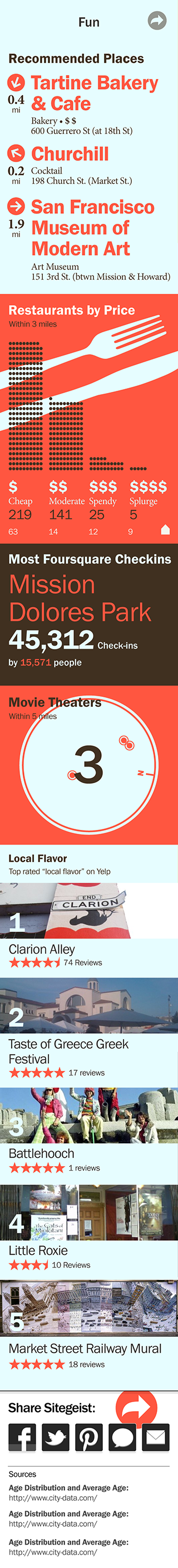
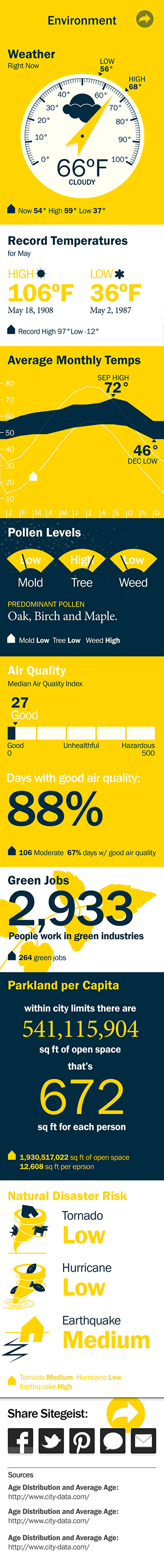
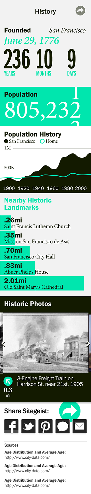
The resulting app, dubbed Sitegeist, helps people access public information about their current whereabouts. Want to know a neighborhood’s average rents? Find a nearby restaurant? See how local residents commute? Sitegeist presents this and other location-based data in an easy-to-digest, at-a-glance format. The app is available free of charge for iOS and Android devices and works everywhere in the United States.
Other mobile apps share government data, but fail to meet the wants and needs of the general public. Instead of putting people first, they dump fleeting, selective data into uninspiring tables and spreadsheets. It is not trivial to successfully engage people with large scale public data. Here, data adds richness to stories and everyday experiences – data isn't interesting on its own.
Achievements
- 30k downloads in 3 weeks, 100k+ currently
- New grants to foundation
- Visibility of Sunlight Foundation to regular consumers
- Awards IDEA 2013, Webby and Core77
- Positive reviews on Gizmodo, GigaOm, GOOD, etc.
- New grants to foundation
- Visibility of Sunlight Foundation to regular consumers
- Awards IDEA 2013, Webby and Core77
- Positive reviews on Gizmodo, GigaOm, GOOD, etc.
IDEO Team
Lead: Belmer Negrillo
Research: Chris Meierling
IaD: Graham Hicks
Research: Chris Meierling
IaD: Graham Hicks
Free Download
The data and features presented here are for illustration of the concept and are slightly different in actual app.
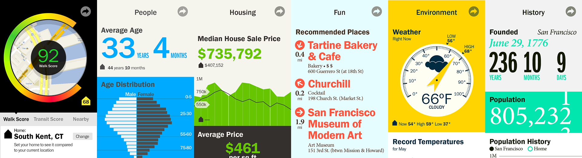
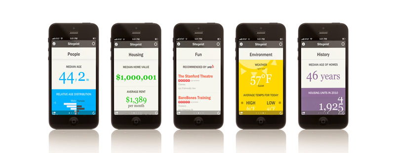
Overview of the App. Only one column is visible a time, and lateral swipe changes active column.
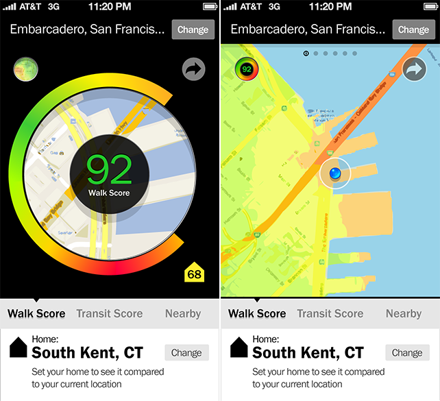
This is a feature that was not implemented. The concept was to provide a way to navigate the city based on a chosen index, for example the WalkScore. This visualization would help users answer questions like: How does this location rate compared to the city? How much does it change across neighborhoods? How does this place compare to where I live?
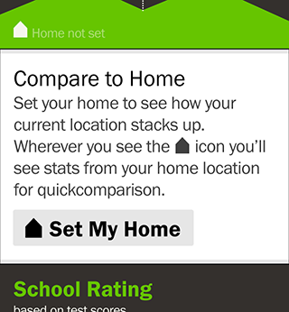
Data is put in context not only to current location, but also to a specified location (Home), so values are put in perspective to a known reference.